

Fuidheigh [Fuiay]
Good walks are even better shared.
Overview
Fuidheigh [Fuiay]
Fuidheigh, a hidden gem of the Scottish Highlands, stands proud at 717 meters, beckoning outdoor enthusiasts and seasoned hikers alike. Known for its rugged beauty and stunning panoramas, it's a Corbett that shouldn't be overlooked.
Geology
The mountain is primarily composed of ancient granite, offering a sturdy foundation for its rocky outcrops and heather-clad slopes. The erosion of this granite has given rise to unique formations, making the landscape as fascinating as it is picturesque.
Routes
The most popular route to the summit is the Sron a’ Ghriogair Route. Starting from the charming Lochailort area, hikers will enjoy a gentle ascent through heather-covered hillsides, culminating in a dramatic final push to the top. This moderate hike provides just enough challenge to keep you on your toes, while rewarding you with breathtaking views at the end.
Summit Features
On reaching the summit, you’ll be greeted by a magnificent cairn, a perfect spot for a celebratory selfie. A small rocky outcrop also provides some welcome shelter from the Highland winds—ideal for enjoying a snack or a quick rest before starting your descent.
Terrain Type
The terrain varies from rocky and rugged to grassy slopes, with a fair share of heather along the way. Some areas near the summit can feel quite exposed, so ensure you're wearing sturdy footwear and taking care of your footing.
Views
Oh, what a view! From the peak of Fuidheigh, you're treated to dramatic vistas of the Knoydart range, the glistening Loch Nevis, and, on especially clear days, the distant Isle of Skye. Spring and autumn are typically the best seasons for crisp, clear views, so plan your trip accordingly.
Hazards
As with all Highland hikes, sudden weather changes are a fact of life. Be prepared for rain, wind, or even snow, regardless of the forecast. There are also steep drops near the summit, so exercise caution and make sure to keep young ones and pets close by.
Nearby Summits
You can also explore adjacent peaks such as Beinn Lios Mor standing at 682 meters and the more towering Sgurr na Ciche at 1001 meters, if you’re feeling particularly adventurous!
Access
For those driving, the nearest parking is a convenient lay-by along the A830 near Lochailort. However, if public transport is more your cup of tea, there are regular buses from Fort William to Mallaig with a stop nearby. The closest town is Lochailort, a quaint village where you’ll find the essentials.
Facilities
Given the remote nature of the mountain, facilities are minimal. However, you can find a welcoming cafe in Lochailort for a post-hike hot drink and a treat.
History
The name ‘Fuidheigh’ meaning 'to hide' perfectly encapsulates this mountain's craggy personality. It holds cultural significance as a landmark revered by locals and featured in various stories handed down through generations.
In conclusion, Fuidheigh isn't just another mountain; it's a place for adventure and discovery. So lace up your boots, pack a good sandwich, and head out to explore this stunning part of the Scottish landscape!
Explore routes near Fuidheigh [Fuiay]
Public walks starting within 80 km of this hill. Nearby does not mean a route reaches the summit; check its map and access before setting out.
Route planning notes
These notes describe possible approaches, not verified navigable routes or permission to cross land. Check current paths, local access rules and conditions before setting out.
Sron a’ Ghriogair Route
This route starts from the scenic Lochailort area and winds up through heather-covered slopes before reaching the summit.
Make a day of it, together
Find someone to share the walk with, or organise a day out along a route you like.
Photo Gallery
View all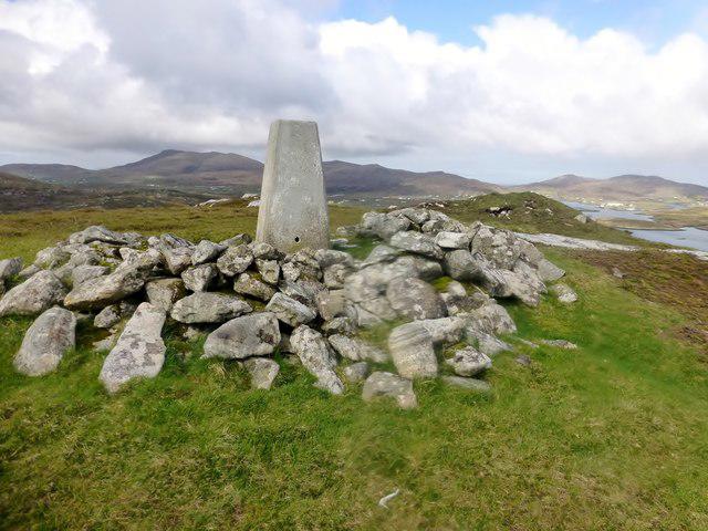 Photo could not load
NF7402 : Fuidheigh [Fuiay]
Rude Health
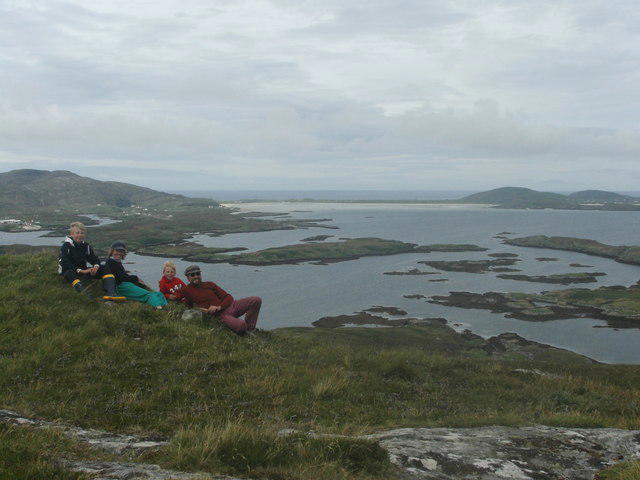 Photo could not load
NF7402 : Summit of Fuiay
John Hughes
Hill facts and local notes
Classifications
Elevation
107m
351 ft
Prominence
107m
Coordinates
56.9961, -7.3698
NF740022
OS Map
31
Explorer: 452N
At the Summit
The summit features a distinctive cairn, perfect for selfies and a sense of accomplishment. There's also a small rocky outcrop that offers a bit of shelter from the winds, which can be a godsend on a blustery day.
Terrain & Geology
Fuidheigh is primarily composed of ancient granite rock, which is typical of the Scottish Highlands, providing a solid base for its rugged features.
Views & Scenery
From the summit, one can see vistas of the rugged rugged peaks of the Knoydart range, the shimmering waters of Loch Nevis, and on a clear day, even the Isle of Skye in the distance.
History & Heritage
Name Origin
The name Fuidheigh derives from the Gaelic term 'Fuidhich', meaning 'to hide', which is fitting considering its craggy facade that shrouds its summit.
Historical Significance
Fuidheigh has been a significant landmark for local communities, often referred to in local tales and folklore.
Getting There & Facilities
Check current local access restrictions, parking rules and transport timetables before travelling. These notes do not confirm public access to the summit.
Parking
There is a small lay-by off the A830 near the village of Lochailort, providing enough space for several cars.
Public Transport
Regular bus services connect Fort William and Mallaig, with stops at Lochailort. A bit of planning might be needed to fit in with the schedule.
Nearby Facilities
While facilities are quite limited, the nearest cafe is a short drive away in Lochailort, where you can enjoy a hot drink and maybe a slice of cake after your adventure.
Safety Information
Known Hazards
- Be mindful of sudden weather changes, as conditions can turn from sunny to stormy in the blink of an eye. Steep drops near the summit require caution.
General Safety Tips
- Check weather conditions before setting out
- Carry appropriate clothing and equipment
- Let someone know your planned route
- Take a map, compass, and GPS device
- Carry emergency supplies: food, water, first aid kit, torch
Hills
Some common questions about the hills answered
Are there group walks up Fuidheigh [Fuiay]?
Many walkers use Walkmates to join or organise walks with others. You can check for group walks around Fuidheigh [Fuiay] through the maps
Are there other walkers around Fuidheigh [Fuiay]?
Activity varies by location and time, but Walkmates lets you see whether others have shared walks or shown interest in this area. Find other people through the walking friends search walking friends for Fuidheigh [Fuiay] search or of course create your own walk for Fuidheigh [Fuiay]
Can I organise a walk to Fuidheigh [Fuiay]?
Yes. If there aren’t any walks listed already, you can create a walk and make it available for others to join.
If you're signed up to Walkmates, you can create a walk to Fuidheigh [Fuiay].
How do I find a walk up this hill?
There are often multiple ways to walk this hill, depending on experience and route preference. Walkmates helps you explore walks and routes that others have shared.
Can I suggest a new route up Fuidheigh [Fuiay]?
Yes. You can suggest or create routes to share with others. Walkmates focuses on the social side of walking, so routes are used to help people organise walks and explore areas together, rather than as detailed navigation tools or route libraries.
Other uses really appreciate knowledgeable walkers sharing their routes. Share your favourite route to Fuidheigh [Fuiay] here
The is an error or something incorrect about this hill. How do I let you know?
We always strive to keep the information on Walkmates as accurate as possible. If you find an error, please let us know through the contact form and we'll aim to correct it as quickly as possible
Community Discussion
Comments
Location
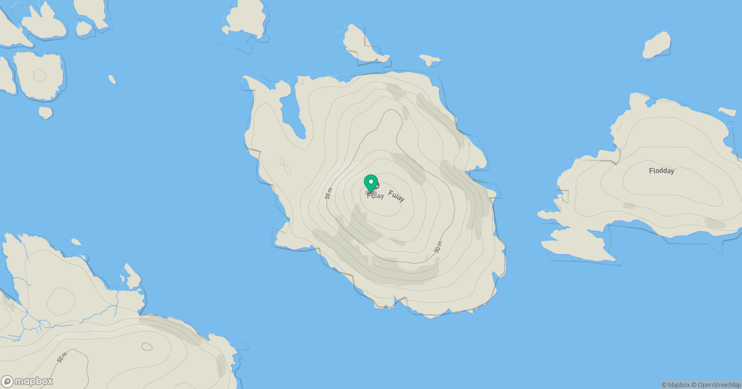
Grid reference: NF740022
View on OpenStreetMapOpens a map in a new tab, centred on the hill.
Hills within 30 km
Straight-line distance, not a walking route or confirmation of access.
No comments yet. Be the first.